

Local Road Closure Information for MS Gong Ride 2025
For over 40 years, tens of thousands of cyclists have ridden the road in this bike ride from Sydney to Wollongong to raise funds for people living with multiple sclerosis.
Road Closures, Lane Closures, Special Event Clearways and Speed Reductions will be in place along specific locations along the route from Sydney to Fairy Meadow on Sunday 2 November 2025 for MS Gong Ride.
Road and lane closures:
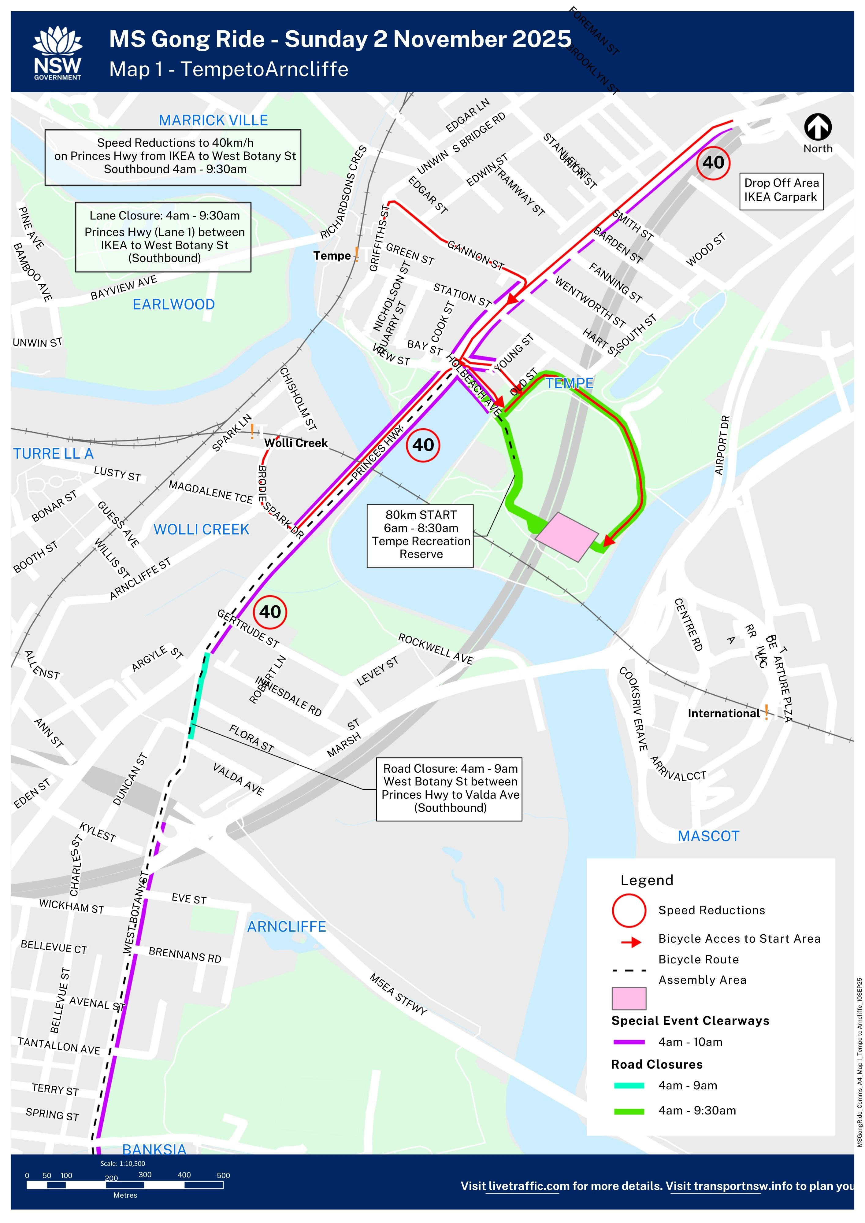
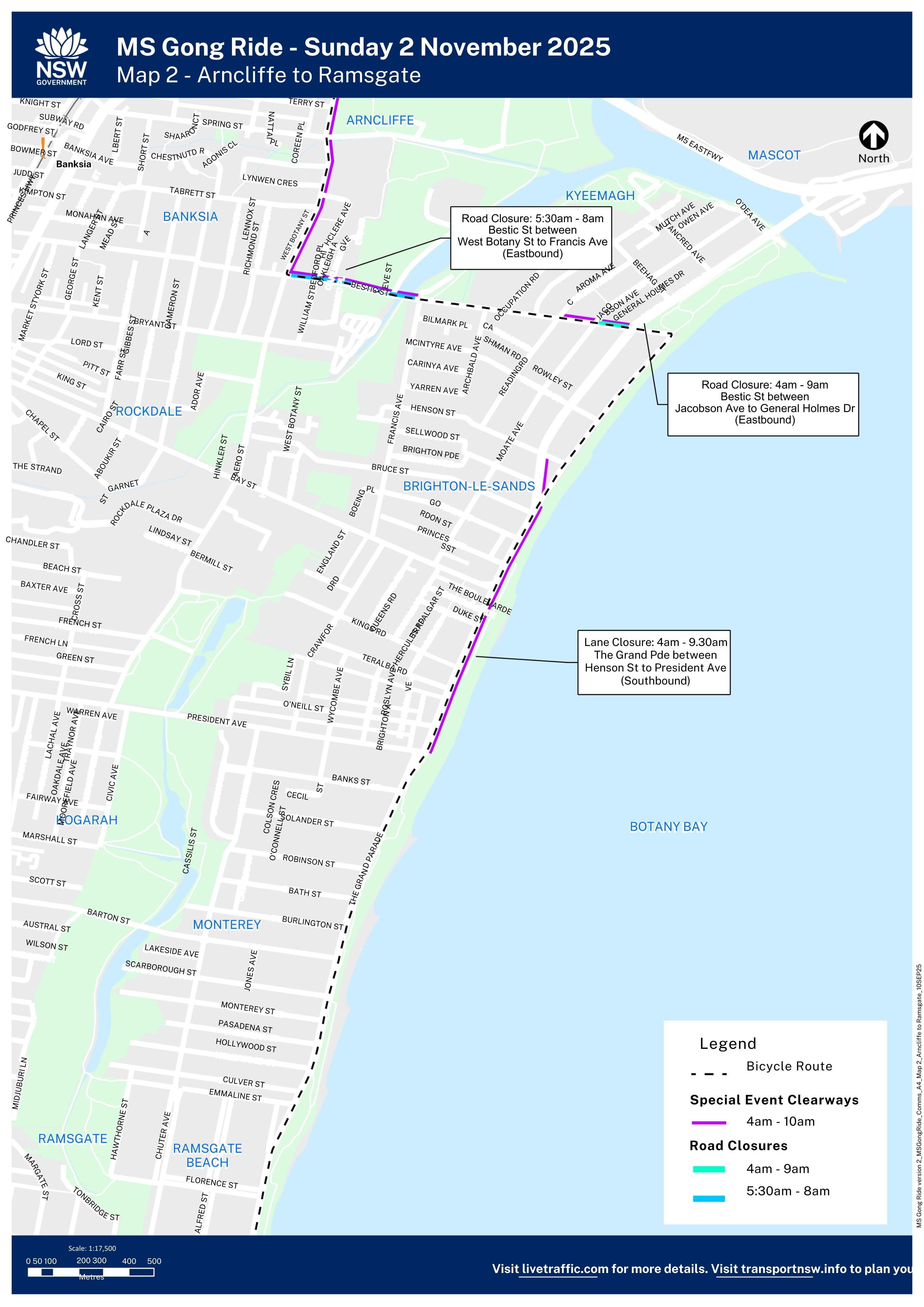
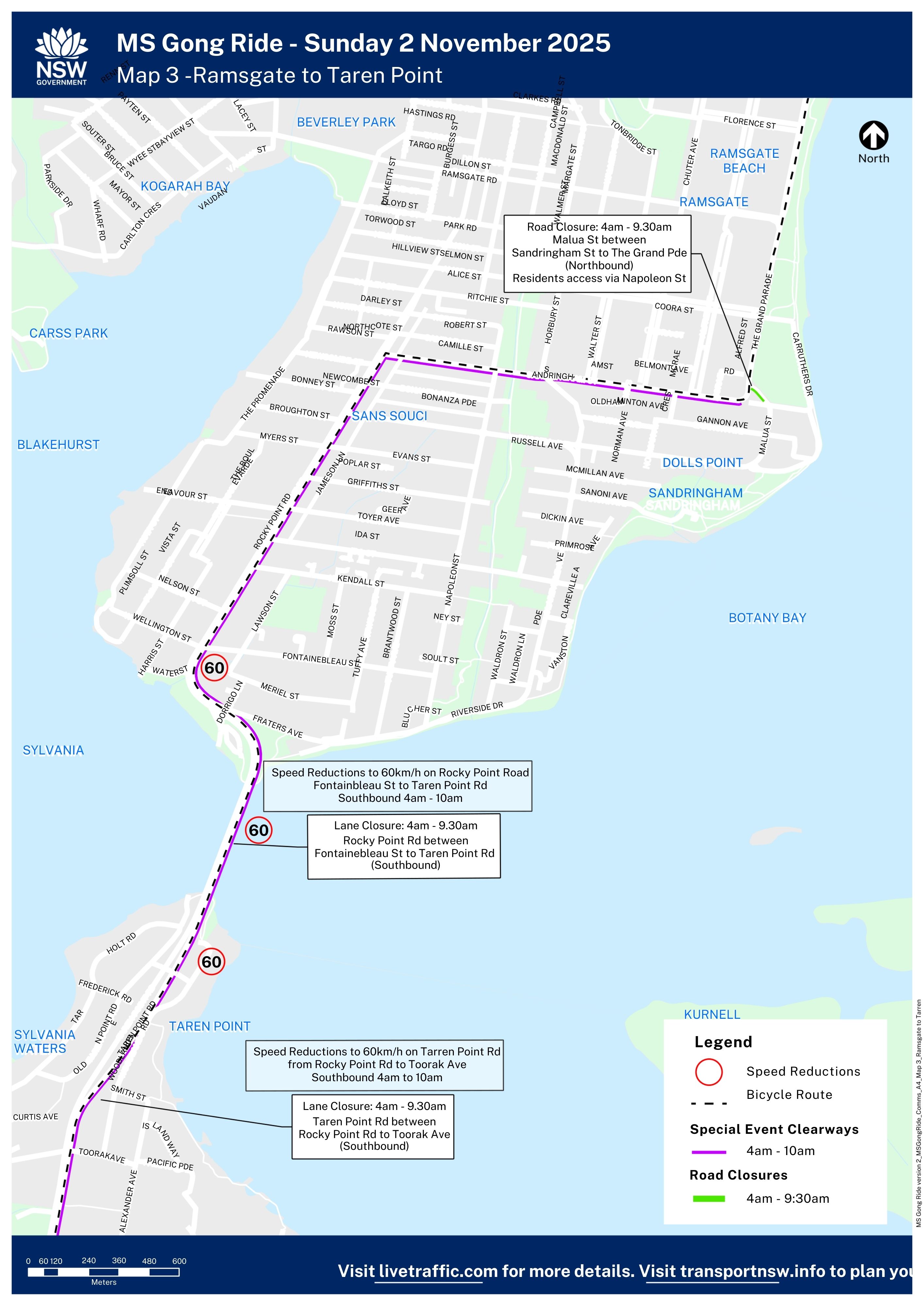
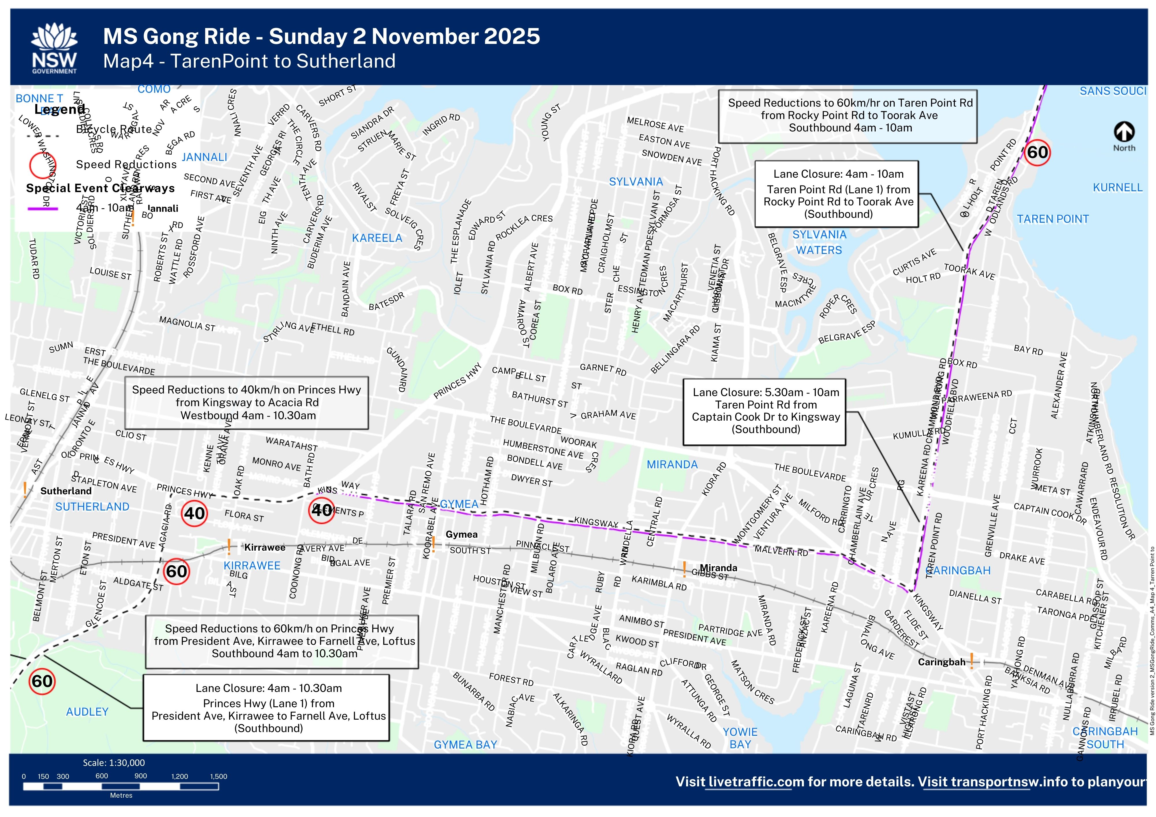
- 4am to 9:30am from Tempe to Sutherland: sections of West Botany St, Holbeach Ave and Bestic St. The speed limit will be reduced to 60/km along Rocky Point Rd/Taren Point Rd from Sans Souci to Taren Point.
- 5am to 10am from Sutherland to Waterfall: Lane closures on the Princes Hwy from Kirrawee to Loftus and the speed limit will be reduced to 60km/h from Kirrawee to Waterfall. Delays are expected travelling southbound on the Princes Hwy during this time.
- 5am to 2:30pm in the Royal National Park: McKell Ave, Lady Wakehurst Dr, Sir Bertram Stevens Dr and Otford Rd. Access to the Royal National Park is via Farnell Ave only. The speed limit will be reduced to 40km/h along Lawrence Hargrave Dr from Stanwell Park to Thirroul from 6am to 3pm.
- 5am to 4.30pm Bulli and Fairy Meadow: sections of Elliotts Rd near the finish area will be closed and the speed limit reduced to 40km/h on sections of Elliotts Rd.
Motorists should exercise caution as cyclists will be sharing some roads along the course. Motorists are reminded when overtaking cyclists to leave a 1.5m distance on roads with speed limits over 60km/h and a 1m distance on roads 60km/h or under.
| Start Location | Distance | Start Time | Start Cut-off Time | Finish |
|---|---|---|---|---|
| Tempe Recreation Park, Tempe | 80km | 6:00am | 8.30am | Thomas Dalton Park, Fairy Meadow Closes from 3.30pm |
| Preston Park, Engadine | 53km | 8:00am | 8.30am |
Special Event Clearways will be in place:
| Tempe to Kirrawee | 4:00am - 10:00am |
| Princes Hwy | 4:00am - 11:00am |
| Stanwell Park to Fairy Meadow | 5:00am - 3:00pm |
Motorists, including TfNSW Mobility Pass Holders and motorcyclists are advised to check signs before parking as vehicles in special event clearways will be towed and fines apply.
Speed reductions and lane closures will also be in place along large sections of the route. Motorists are advised to exercise caution as cyclists will be sharing the road in some areas.
Patrons attending MS Gong Ride are advised to use public transport as there will be very limited participant drop off areas at both start sites. For timetables, maps, and trip planning visit www.transportnsw.info.
For any questions or concerns about local access arrangements, please contact the MS Events Team on events@msplus.org.au prior to or on the event day.

Arncliffe to Ramsgate Map
Download
Ramsgate to Tarren Point Map
Download
Tarren Point to Sutherland Map
Download
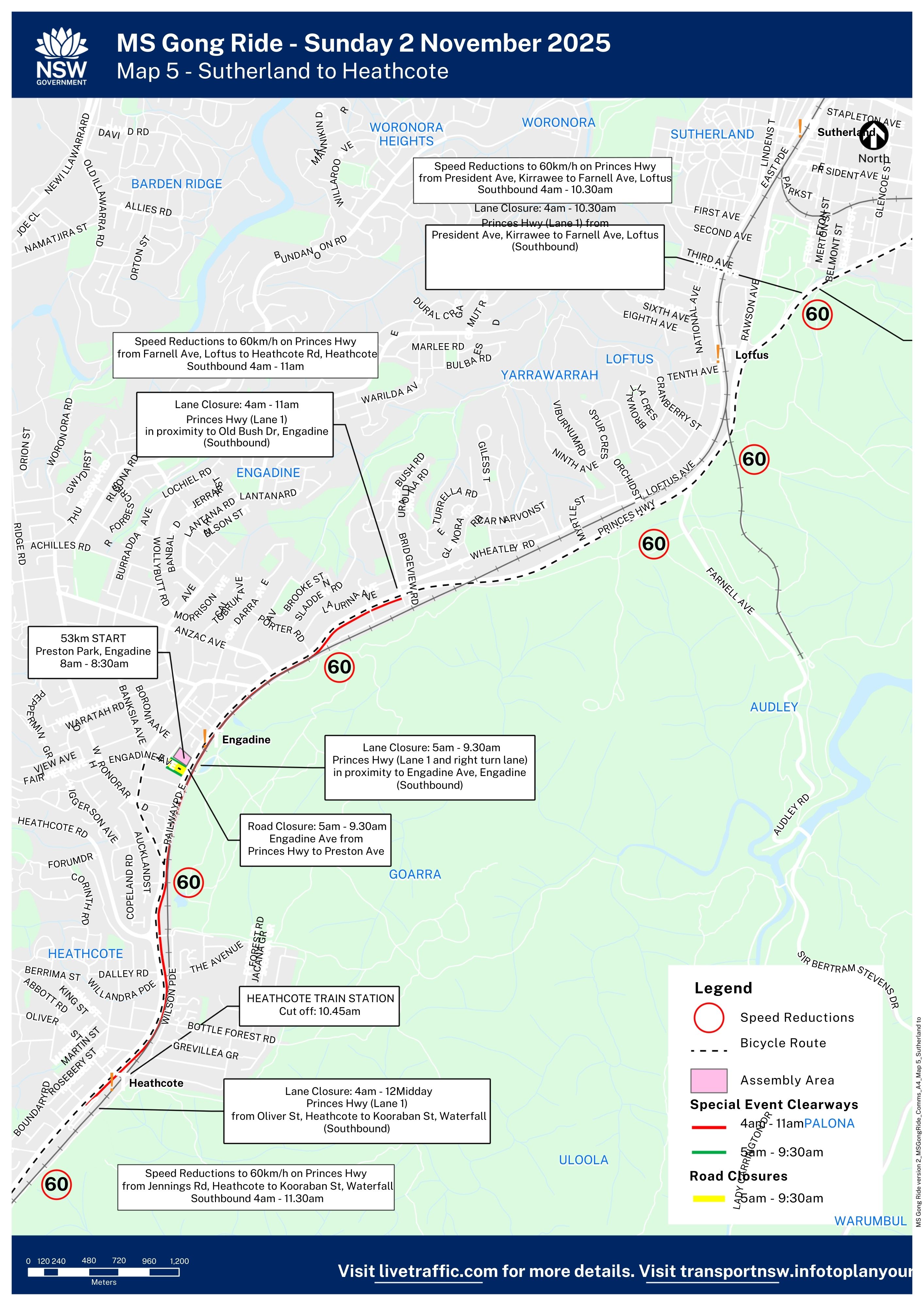
Sutherland to Heathcote Map
Download
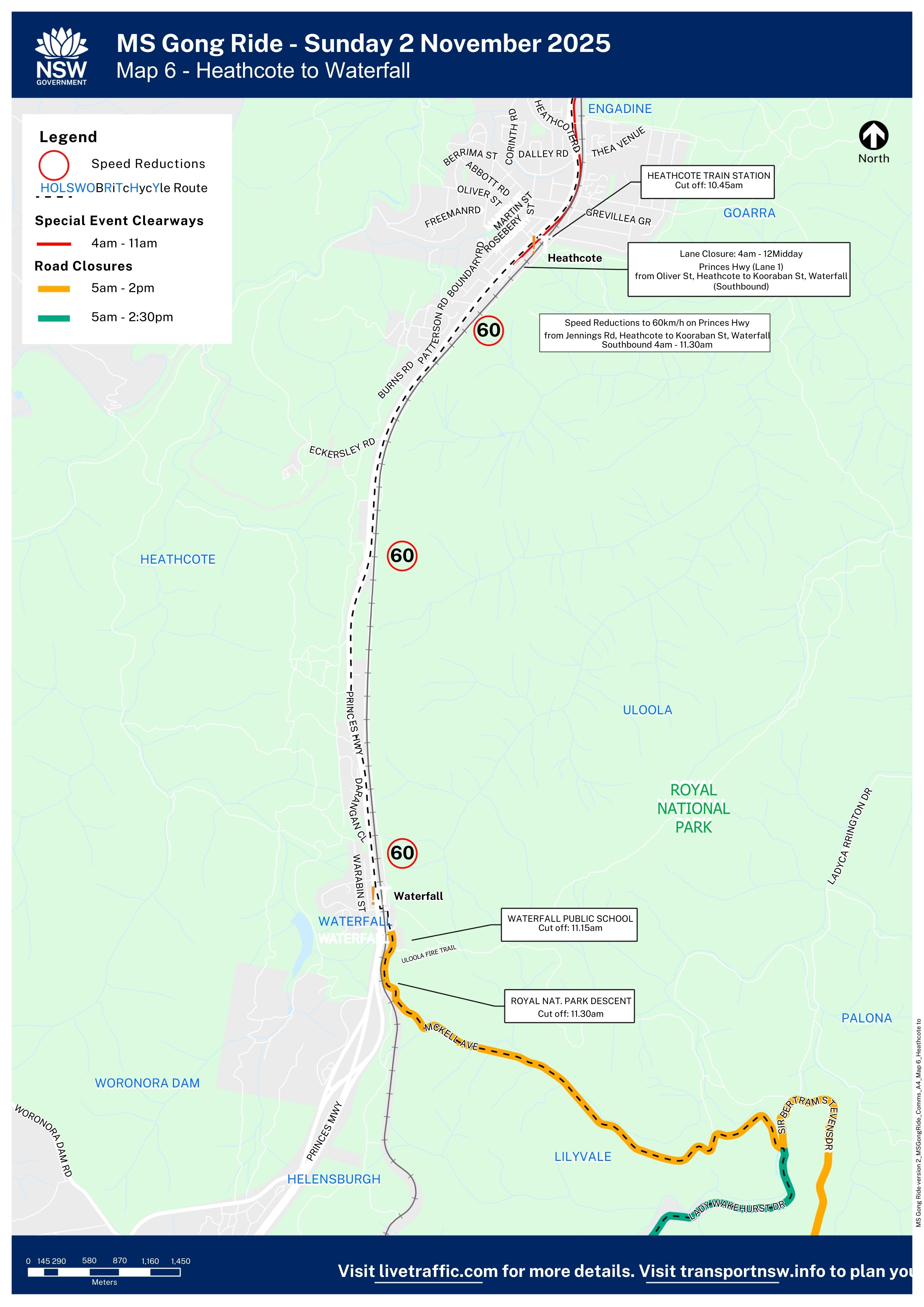
Heathcote to Waterfall Map
Download
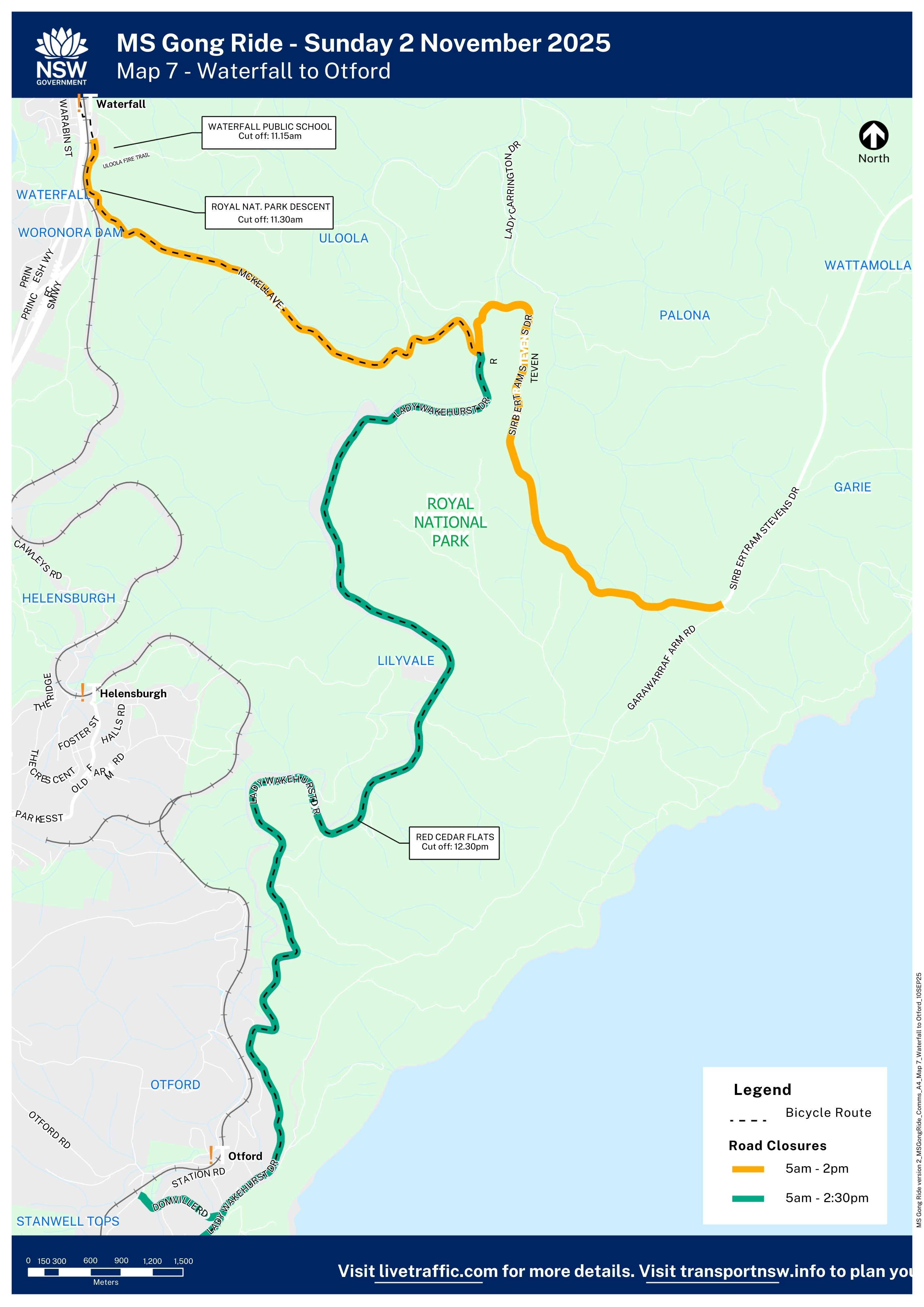
Waterfall to Otford Map
Download
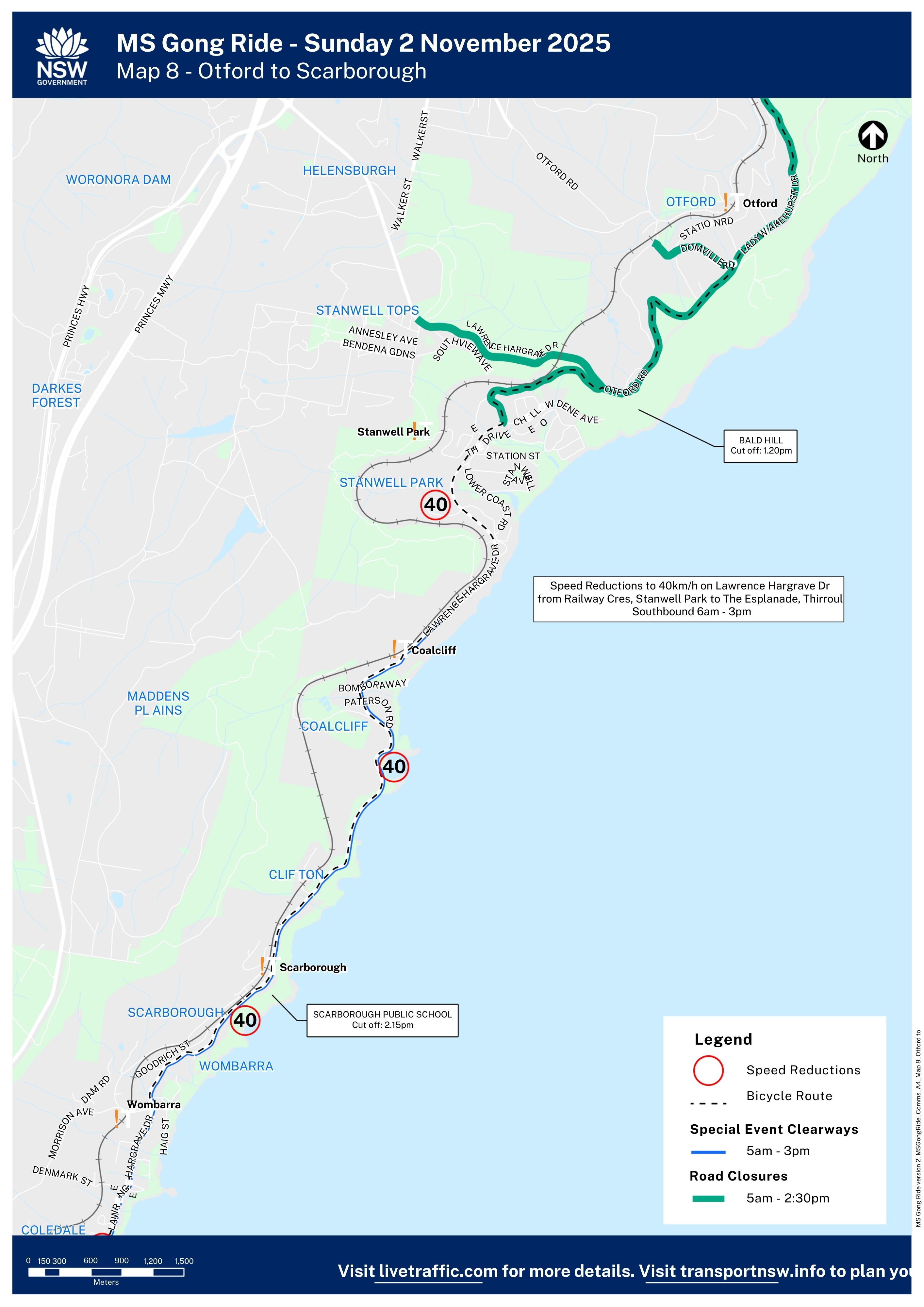
Otford to Scarborough Map
Download
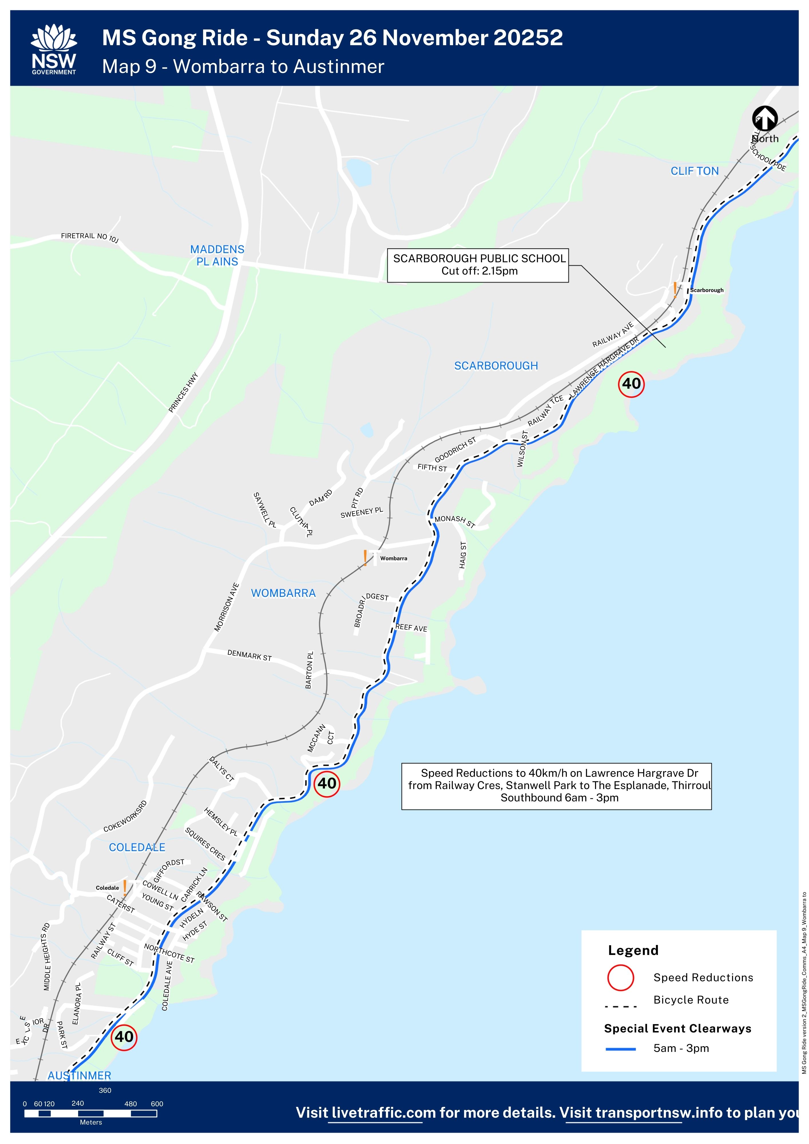
Wombarra to Austinmer Map
Download
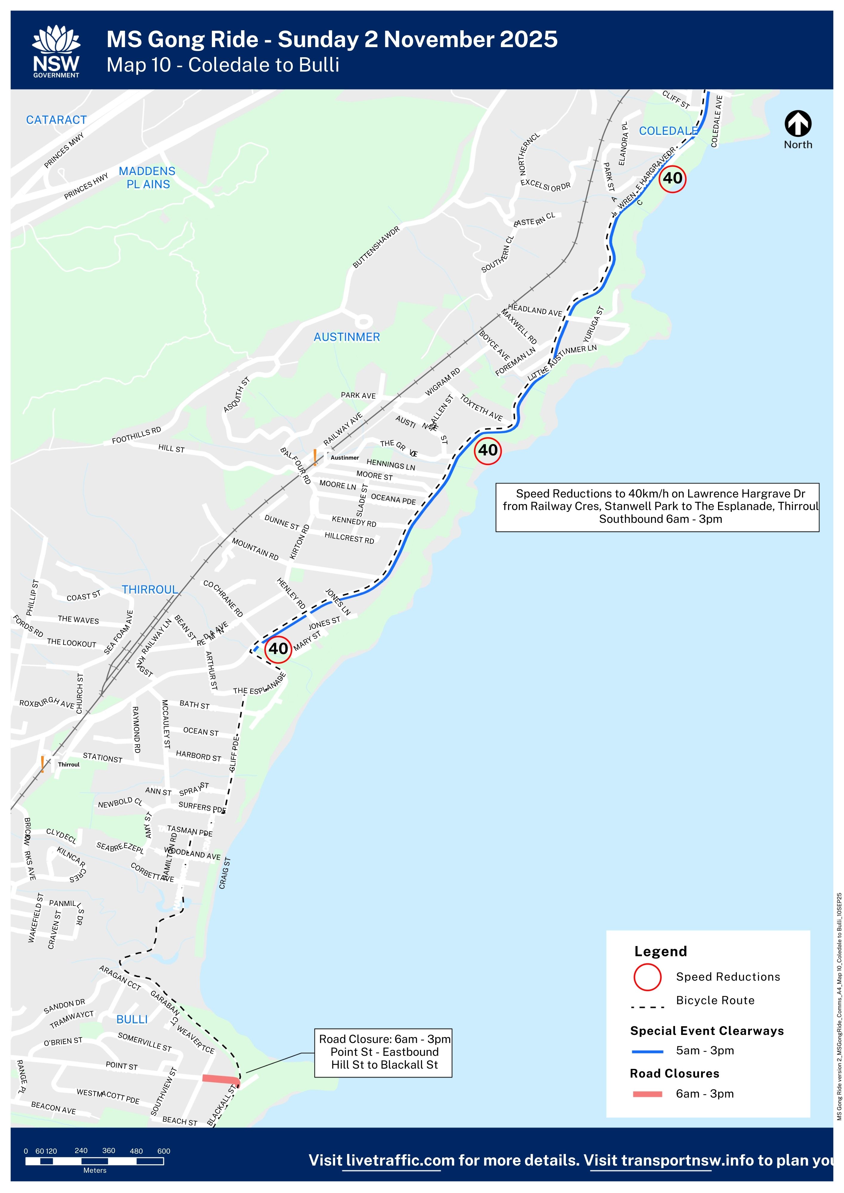
Coledale to Bulli Map
Download
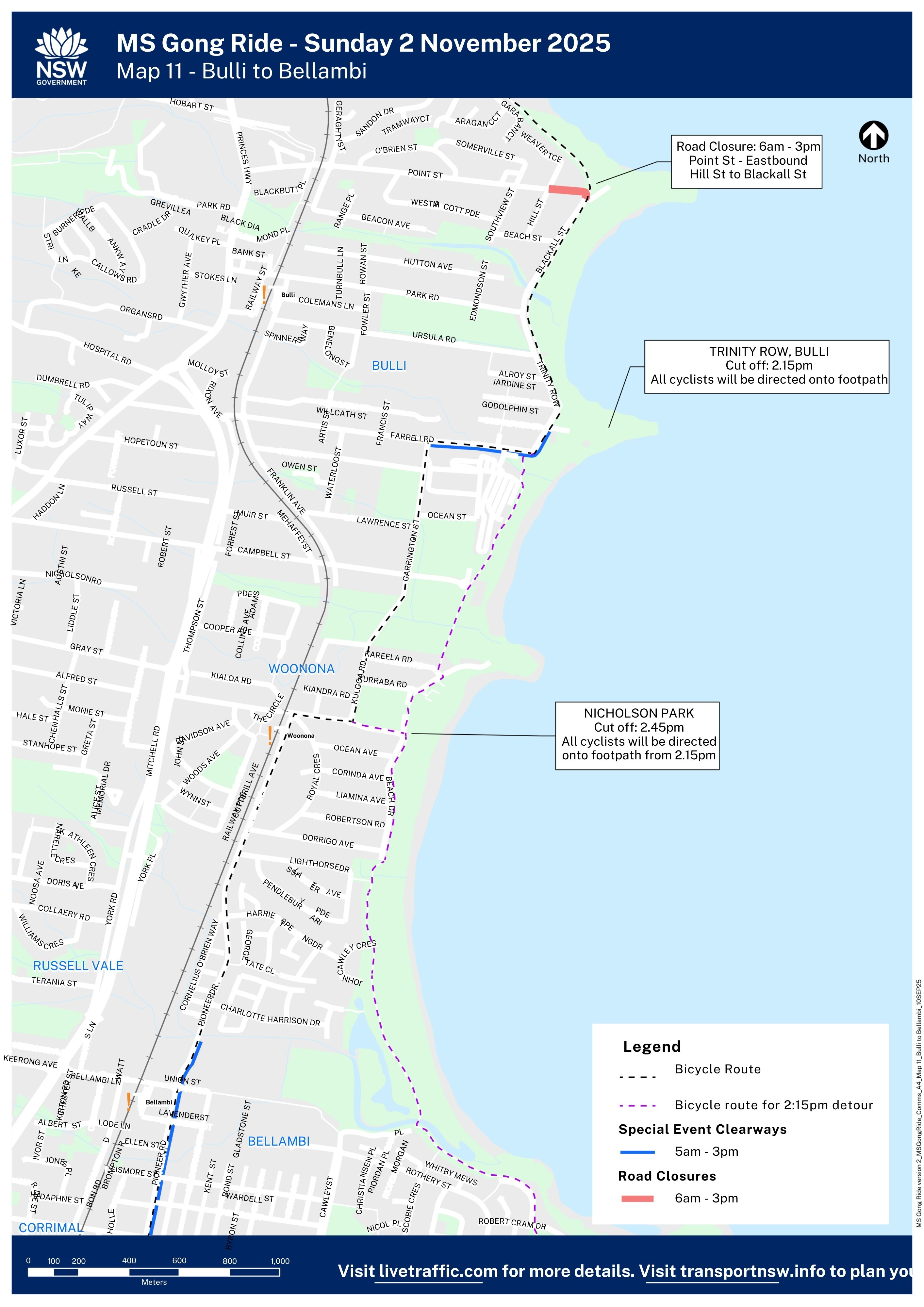
Bulli to Bellambi Map
Download
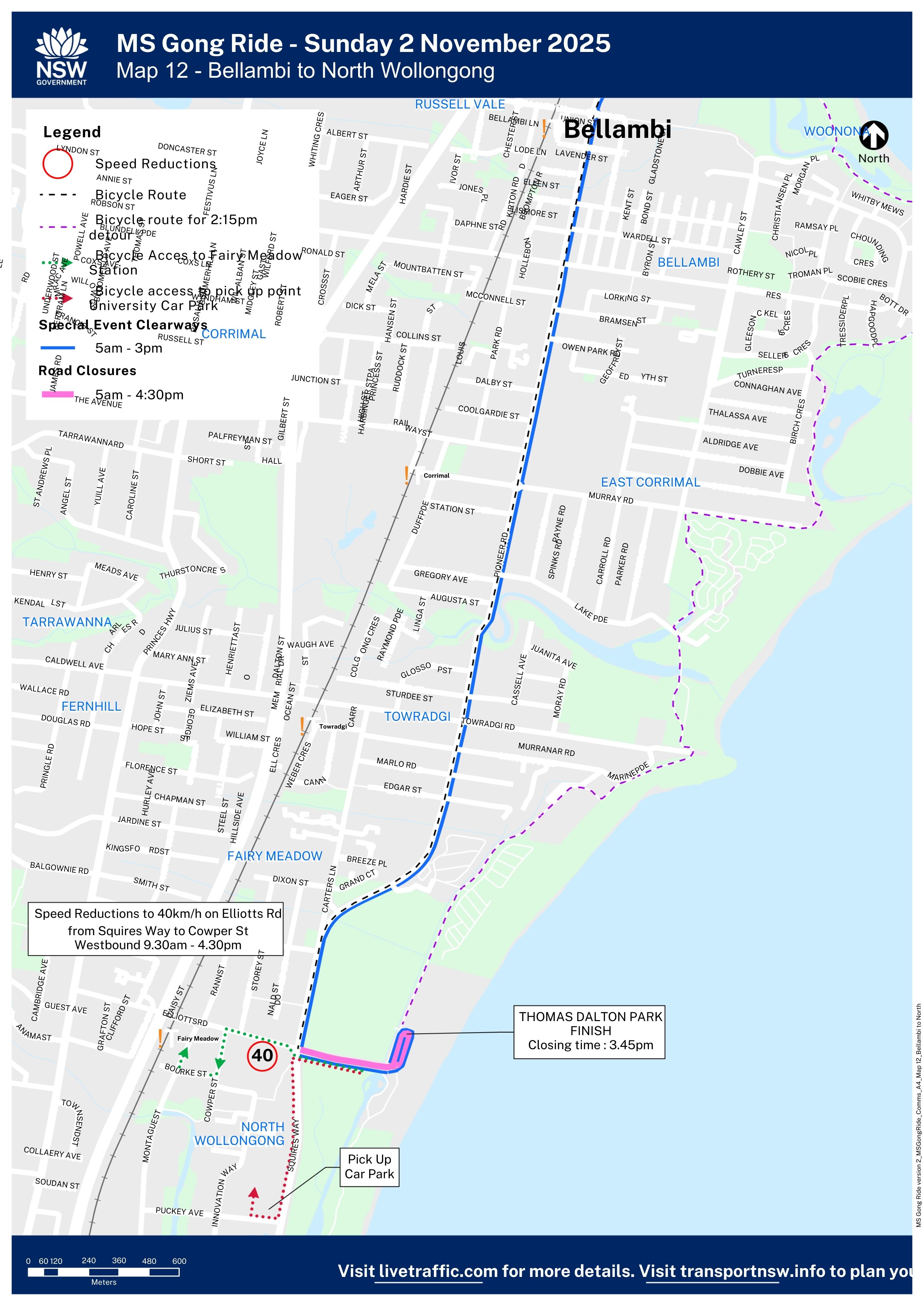
Bellambi to North Wollongong Map
Download


